
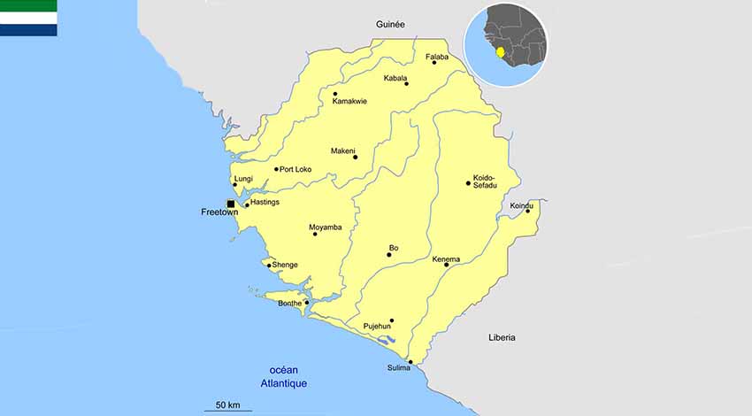
1.1 Geographic and politics characteristics of Sierra Leone
Political system
Following the American Revolution, a colony was established in 1787 and Sierra Leone became a destination for resettling black loyalists who had originally been resettled in Nova Scotia.
After the abolition of the slave trade in 1807, British crews delivered thousands of Africans liberated from illegal slave ships to Sierra Leone, particularly Freetown. The country obtained its independence in 1961. The President is directly elected by simple majority popular vote for a 5-year term (eligible for a second term limits); last election held on 7 March 2018 (next to be held in March 2023).
After the abolition of the slave trade in 1807, British crews delivered thousands of Africans liberated from illegal slave ships to Sierra Leone, particularly Freetown. The country obtained its independence in 1961. The President is directly elected by simple majority popular vote for a 5-year term (eligible for a second term limits); last election held on 7 March 2018 (next to be held in March 2023).
- Area : 71.740 km2
- Population : 6.312.212 (July 2018)
- Density : 89 people/km2
- Population growth rate : 2.4%
- Urban population : 42.1% (2018)
- Official language : English
International agreements
Member of ECOWAS, Sierra Leone is also member of West African Monetary Zone with Cabo Verdo, Ghana, Gambia, Guinea, Liberia and Nigeria and Mano River with Cote d’Ivoire, Guinea and Liberia.
1.2 Macroecononic Framework
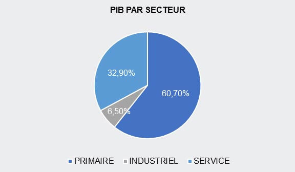
1.3 Economic performance and outlook of Sierra Leone
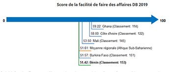
1.4 Ease of Doing Business
- Benin (capital : Porto-Novo)
- Burkina Faso (capital : Ouagadougou)
- Cape Verde (capital : Praia)
- Ivory Cost (capital : Abidjan)
- Gambia (capital : Banjul)
- Ghana (capital : Accra)
- Guinea (capital : Conakry)
- Guinea Bissau (capital : Bissau)
- Liberia (capital : Monrovia)
- Mali (capital : Bamako)
- Niger (capital : Niamey)
- Nigeria (capital : Abuja)
- Senegal (capital : Dakar)
- Sierra Leone (capital : Freetown)
- Togo (capital : Lomé)


